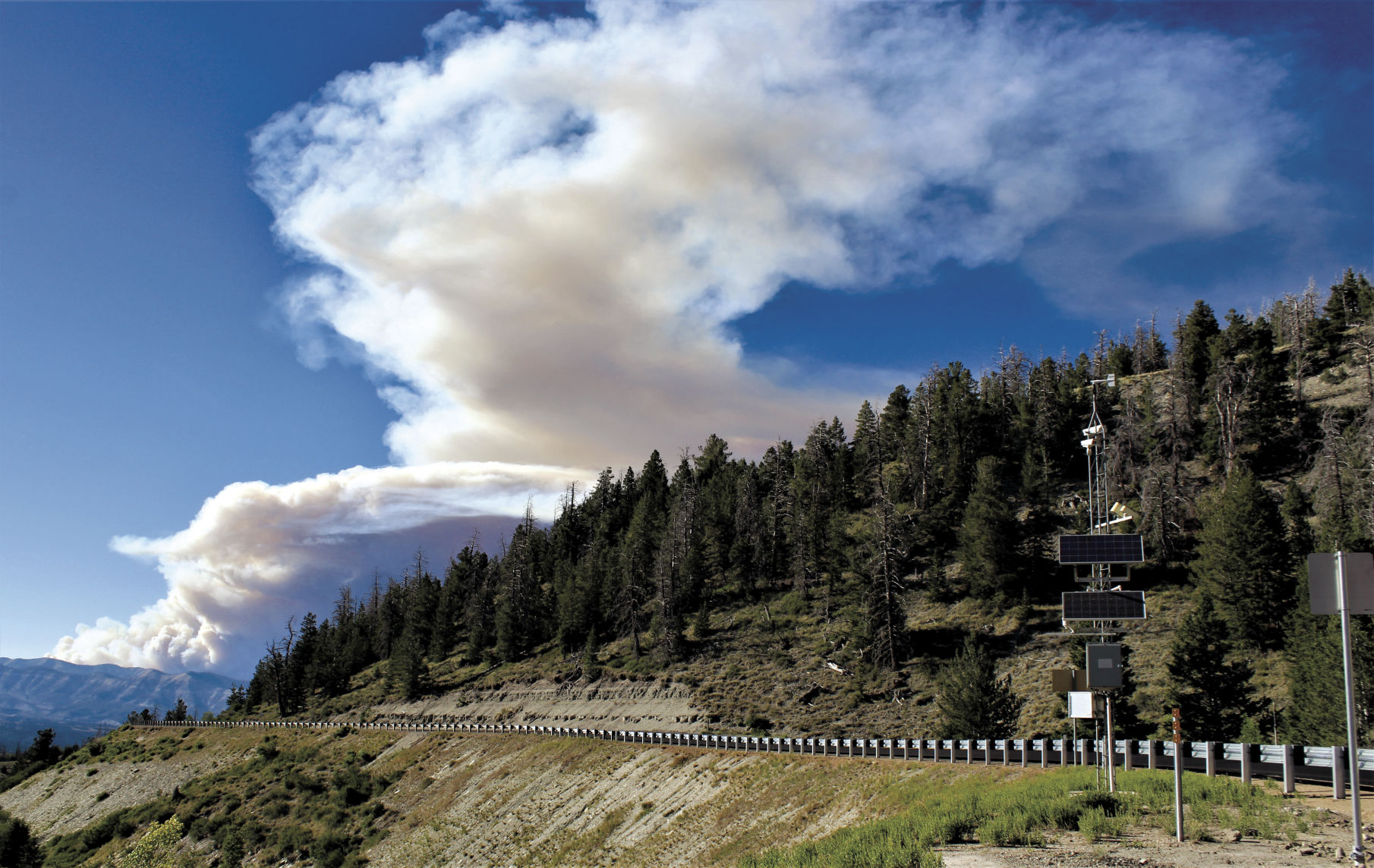
Fast-moving blaze southeast of Strawberry Reservoir spreads to 7,000 acres
Just as wildland firefighters appear to have the Trail Mountain Fire under control in the nearby Manti-La Sal National Forest, a new wildfire is burning fast between Beaver Canyon and Twelve Hundred Dollar Ridge five miles southeast of Strawberry Reservoir.
The blaze scorched nearly 7,000 acres within the first 24 hours, the team responsible for suppressing the blaze reported Monday.
Smoke from the fire could be seen as far away as Moab and Park City.
Human activity is suspected in the fire’s cause, though was not yet confirmed as of press time.
Up to 10 cabins in the Wasatch County area of the fire were ordered evacuated. The blaze spread across county lines to Duchesne County, where law enforcement was put on notice to prepare to evacuate some homes near the fire zone.
A Type 2 incident management team was ordered to tackle the Dollar Ridge Fire as of Monday due to the complex terrain and quick pace of the fire’s spread.
Meanwhile, closer to home, a red flag warning was issued Monday near the Trail Mountain fire due to hot and dry weather conditions. The warning is in effect through today.
Cleanup efforts continue around the Trail Mountain fire zone as firefighters continue to keep the fire contained at 85 percent containment.
The Trail Mountain Fire began June 4 with a 300-acres prescribed burn that got out of control. So far the blaze has scorched 18,011 acres.
A Burned Area Emergency Response team (BAER) was called into the national forest on June 27 to assess the fire scar. The team is looking at the threat steep, scorched slopes may pose when post-fire rainstorms occur.
“The slopes, combined with the loss of canopy cover, ground cover, and the formation of water repellent soils, can lead to an increased watershed response to short duration, high intensity precipitation,” according to a press release last week from the U.S. Forest Service. “Floods and debris flows are the likely result when heavy rain hits the fire damaged slopes.”
The BAER team is made up of hydrologists, soil scientists, wildlife biologists, geologists, range conservationists, and engineers. It consults with the Utah Division of Wildlife Resources on the impacts to wildlife habitat and fisheries.
“The team’s work must be completed quickly. It has only days to make a rapid assessment of the burned area to evaluate the burned watersheds and determine the potential for increased post-fire flooding, sediment flows, and rock slides that may pose an unacceptable risk to critical resource values,” according to the forest service press statement.
While the BAER team continues its work, the Trail Mountain Fire response will wind down.
Over the next several days, the incident team will be demobilizing and reassigning resources to other fires.