The preliminary water management plan for the West Colorado River Basin stresses conservation.
Encompassing Carbon and Emery counties, the basin is comprised of five separate drainages that flow into the Colorado River system, points out the preliminary plan developmed under the direction of the Utah Board of Water Resources.
The drainages include the Price, San Rafael, Dirty Devil, Escalante and Paria rivers.
Located in south-central Utah, the basin covers nearly 9.8 million acres or 15,000 square miles of land. Elevations range from 11,530 feet to about 3,700 feet, with precipitation registering from more than 30 inches to less than 8 inches.
Private properties cover about 8 percent of the basin. Federally administered lands account for 86 percent and state lands 6 percent of the area.
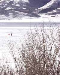
The basin contains natural scenic locales like Capitol Reef National Park and portions of Bryce Canyon, Canyonlands, Glen Canyon – Lake Powell and the Grand Staircase-Escalante monument. Three national forests and eight state parks are located within the boundaries.
Although the Anasazi, Fremont and Sevier cultures may have irrigated land for crops as early as 1,500 years ago, livestock grazers from Sanpete County settling in Emery County in the late 1800s were the first modern irrigators.
Settlements rapidly sprang up all around the basin along with small developments for culinary and irrigation water.
Construction of storage reservoirs became necessary to manage the basin’s water resources around 1900.
In 1917, Carbon County began to develop water resources with the attempted construction of Mammoth dam, located 100 feet downstream of Scofield.
The Mammoth project failed, but the initial Scofield dam was completed in 1926 to irrigate about 25,000 acres near Price in Carbon County.
The first structure was eventually deemed unsafe and the existing Scofield dam was completed in 1946 as the first phase of the United States Bureau of Reclamation’s 1933 project plan.
BOR’s Emery County water storage project was completed in 1966. The project provides irrigation and power plant cooling water in western Emery County through Joes Valley and Huntington North reservoirs.
Millsite was funded by the water resources board and the U.S. Department of Agriculture in 1971 as part of the Ferron watershed project. Millsite stores water for agriculture, municipal and industrial uses around Ferron. Utah Power completed Electric Lake in 1973 to provide water storage for the Huntington plant.
Wayne County ‘s largest storage projects began with the 1889 purchase of Fish Lake from the Paiute Indians. Johnson Valley Reservoir was built in 1899. Forsyth was completed in 1917 and the water resources board financed construction of Mill Meadow in 1955. The reservoirs store water for Rabbit Valley.
Garfield County ‘s large storage reservoirs include Jacobs Valley, built in 1911 by Pine Valley Irrigation Company, and Wide Hollow, completed in 1954 by New Escalante Irrigation Company. The reservoirs provide water for irrigation in and around Escalante.
The majority of the basin’s water supply or a total yield of 630,000 acre-feet comes from precipitation. Little water in the mainstreams of the Green or Colorado rivers is used in Utah.
Approximately 4.0 million acre-feet annually enter Lake Powell from the Green River and 5.4 million acre-feet enter from the Colorado.
Located in Kane, Garfield and San Juan counties, Lake Powell provides 7.5 million acre-feet to California, Nevada and Arizona, as required by the 1922 Colorado River Compact.
During the last 20 years, about 10.7 million acre-feet have been released downstream through Glen Canyon.
In 1998, the basin’s population totaled approximately 38,400 people. The population is expected to expand to 50,000 residents by 2020.
The projected population expansion rate registers at 1.2 percent, lower than the 2 percent state average.
All five river drainages in the basin start in the high elevations of the Wasatch, Fishlake, Awapa, Aquarius or Paunsaugunt plateaus and flow down to enter the Green or Colorado systems. Thirteen exports deliver 9,340 acre-feet of water to the Sevier River system. Another small export of about 100 acre-feet is delivered from the Price River drainage to the Utah Lake Basin.
The major water import into the basin is 4,800 acre-feet from the east fork of the Sevier.
Total water depletions in the basing registered at approximately 205,100 acre-feet in 1998. The figure is expected to climb to about 229,000 acre-feet by 2050.
Diversions included 295,050 acre-feet for agricultural irrigation, 14,600 for culinary purposes and 8,367 acre-feet for secondary lawn-garden uses.
Industrial demand registers at 36,292 acre-feet annually. The four power plants in Carbon and Emery counties account for about 32,000 acre-feet of the industrial total.
Management of water resources became imperative when demands exceeded the average long-term supply. More than 40 reservoirs have been constructed and 92 culinary water systems currently serve 95 percent of the basin’s population.
Several environmental factors could affect future development, indicates the preliminary water management plan.
Currently, 1,731,000 acres of BLM wilderness study areas are located in the basin and 1,523,000 acres are being considered for designation.
Presently, 295,050 acre-feet of water are diverted onto 91,924 acres of irrigated lands across the basin. About 285,050 acre-feet comes from surface supplies and 10,000 acre-feet from groundwater.
Like most areas in Utah, the basin lacks a full water supply for all irrigable lands. Problems with low on-farm application efficiencies affect some areas. In addition, overgrazing in upper watersheds has caused erosion.
Increased irrigation efficiency and restoring as well as maintaining healthy watersheds can help to overcome the future supply problems faced by the basin.
Approximately 60 percent of the 14,075 acre-feet drinking water supplies come from surface treatment plants. The remainder comes from groundwater through springs or wells.
Thirty-three community and nearly 60 small public culinary systems operate within the basin.
Public community systems delivered 10,504 acre-feet of culinary quality water in 1996. The basin-wide use registered at 253 gallons per capita per day, slightly lower than the 268 gpd statewide average.
Secondary use in the basin was 196 gpcd, compared to 56 gpcd statewide.
Total per capita use in the basin registered at 449 gpcd, compare to a statewide average of 324 gpcd.
Consumption levels in the West Colorado River Basin varied from 197 gallons per capita day in Emery County to 335 gallon in Wayne County.
Culinary demand will climb to more than 19,000 acre-feet in 2020, predicts the management plan.
The water will come from existing undeveloped rights, according to the preliminary management plan.
Agricultural water rights may also be converted to culinary use in the future.
The highest water quality in the West Colorado River Basin is found in the upper reaches of the five river drainages, points out the preliminary management plan.
As the water flows downstream into the basin ‘s five drainages, the quality deteriorates.
The Price, San Rafael and Dirty Devil rivers flow through marine shales and sandstone surface geologic formations.
Deep percolation from agricultural lands over the mancos shale, soils and rocks can produce return flows having high dissolved solid saline levels.
Upon completion, the Price-San Rafael unit of the salinity control program is expected to treat approximately 16,350 acres of farmland with gravity pressure irrigation and 9,650 acres with pump sprinkle systems.
The federally funded water quality project will reduce salt loading into the Colorado River system by 161,000 tons per year, estimates the preliminary management plan.
Coordination is needed to offset climbing population and tourism demands throughout the basin.
The preliminary management plan identifies conservation as one of the most economical options.
Conservation of irrigation water can be achieved through improved efficiencies.
Culinary usage can be reduced with low volume plumbing fixtures, improved outside watering application efficiencies, replacing high moisture landscapes with native vegetation and changing price rate structures to encourage conservation.
Industrial demands are not expected to expand significantly in the future, according to the management plan.
Water requirements for industry will total 41,310 acre-feet in 2020. Most of the increases will be for light industries using culinary water from existing suppliers.
Groundwater is not a major resource in basin, points out the preliminary management plan. There is an absence of productive and easily developed alluvial aquifers. The unfractured consolidated aquifers generally have hydraulic properties that are not conducive to large-scale development.
The quality of the groundwater is unsuitable for domestic, municipal and/or agricultural uses.
Past research studies indicate there may be several million acre-feet of water in the Navajo sandstone, a 400- to 1,600-foot thick aquifer underlying most of the basin.
Additional studies are needed to determine the quantity and quality of the water resource.
An economic analysis must also be conducted to determine the viability of developing the water resource in Navajo sandstone, concludes the preliminary management plan.
Preliminary water management plan focuses on conservation