Dollar Ridge Fire spreads to 52,000 acres
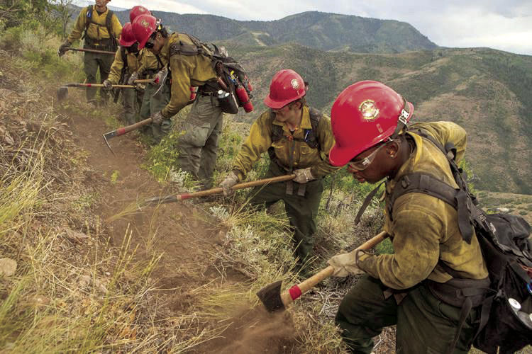
According to the U.S. Forest Service, the Trail Mountain Wildfire is 90 percent contained, with only a few areas smouldering on the ridges above the Crandall Canyon Mine. The fire started as a controlled burn but quickly got out of control and eventually burned more than 18,000 acres.
Recreationists in Huntington Canyon are now being advised of a new closure order in the area of the fire as well as new restrictions for most lands within the National Forest boundaries of the Ferron-Price and Sanpete Ranger Districts.
A new closure order was enacted by the Manti-La Sal National Forest on July 3 for the Trail Mountain Fire area. Some roads, trails, and facilities have been added to the closure list and some have been removed.
Those removed from the order include Indian Creek Campground, Horse Canyon Trailhead, Cottonwood Canyon Road, Trail Mountain Road, Forest Road 2181, the CCC Trail, Meetinghouse Trail, East Mountain Trail, Scad Valley Trail, and Horse Canyon Trail.
The restricted area is described as beginning at the junction of East Mountain Road and National Forest System Road 0145, then north along East Mountain Road to the ridge between Blind Canyon and Horse Canyon, then down this ridge to Utah State Highway 31, then south along Highway 31 to the ridge between Rilda Canyon and the North Fork of Meetinghouse Canyon, then west along this ridge to FS Road 0145, then north along this road to the junction with East Mountain Road. The closure includes all facilities, camping areas, roads, and trails in the described area. A map of the restricted area is available on the Manti-La Sal National Forest website.
The new fire restrictions went into effect at 12:01 a.m. Monday, July 9 and continue until Nov. 1 or until rescinded. Fire danger remains very high and the new restrictions, added to already existing restrictions, prohibit fires outside a fire structure that is provided by the Forest Service within a designated area, and smoking outside an enclosed vehicle or building.
The possibility of flooding and debris flows is also a concern. The Trail Mountain Burned Area Emergency Response (BAER) Team coordinated with the U.S. Geological Survey staff to evaluate the Trail Mountain Fire burn area to strategically assess potential post-fire impacts to the watersheds and debris flow predicted response during damaging storm events.
Everyone near and downstream from the Trail Mountain Fire burn area should remain alert and stay updated on weather conditions that may result from heavy rains over the burn scar. Flash flooding could occur quickly during heavy rain events.
Only a little more than 120 personnel are still working the Trail Mountain Fire, which is estimated to be fully contained by Aug. 1.
Meanwhile, some of the resources utilized to fight the local wildfire are now being utilized in the battle to contain the Dollar Range Fire, which has spread to more than 52,000 acres as of press time. That wildfire started July 1 just five miles southeast of Strawberry Reservoir. Flames are now close to the confluence of Strawberry River and the reservoir’s southern most shores.
Officials with Great Basin Team #2 confirmed Monday that human activity was to blame for the fire’s start, though they would not specify exactly what type of activity was the cause. The fire’s cause remains under investigation.
A community meeting with fire officials was set for yesterday at Duchesne High School. More than 800 fire personnel are involved in suppression operations.
The Dollar Ridge blaze, which is burning in both Wasatch and Duchesne counties on both sides of the Strawberry River, is said to be about 35 percent contained, according to the latest update.
Weather may help firefighters as scattered thunderstorms are forecast for the next few days.
The fire is burning faster to the south and west, according to reports.
“There is a high potential for fire growth to the south and west with the fire spreading through large dead and down stands of timber stringers,” according to a website dedicated to keeping the public updated.