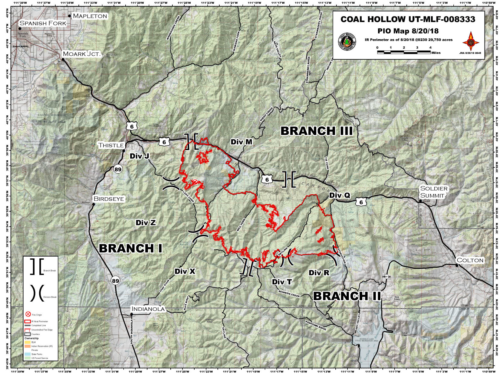
Burn area at 30,000 acres, but containment increases to 47%
Strong winds tested firelines at the Coal Hollow wildfire this weekend. The lines held for the most part, helping increase containment to nearly 50 percent by Monday.
Fire officials report that the increase in acreage burned is mostly due to firing operations meant to clear fuel in the blaze’s path.
Mandatory evacuations that were ordered last week inside the Uinta-Wasatch-Cache National Forest north of Highway 6 and inside the Manti-Lasal National Forest east of Starvation Road have been lifted. Pre-evacuation orders, however, remain in place in those locations.
A number of forest roads and trails remained closed to public use.
Fire crews were still waiting for more favorable conditions Monday morning before beginning burnout efforts between the fire’s edges and Highway 6. Pockets of fuel remain a potential issue along the highway corridor.
Fire crews may catch a break this week as thunderstorms are forecast for much of the week.
Still, smoke from the Coal Hollow blaze is combining with smoke from a new fire, the Bear Trap Fire, north of Green River that has already scorched 10,000 acres. The smoke from those two blazes as well as that wafting in from fires in other states is contributing to the thick blanket of smog filling the Castle Country’s air.
The public, especially people with respiratory problems, is urged to reduce outdoor activities until conditions improve.