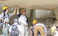
| Students from the University of Pennsylvania participate in their yearly field camp. They came all the way to Helper in order to examine a particular outcropping of rock. The unique geological conditions in Utah have led to many educational projects including the U of U’s seismology work. |
A University of Utah report issued June 2 indicates seismological activity during the Crandall Canyon disaster last August covered 50 acres of land before concluding.
“New calculations show that the deadly Crandall Canyon mine collapse, which registered as a magnitude 3.9 earthquake, began near where miners were excavating coal and quickly grew to a 50 acre cave in,” states the U of U press release detailing the data.
According to the release, U of U seismograph stations estimated the size of the collapse as about four times larger than was thought shortly after the Aug. 6, 2007 disaster.
The initial incident resulted in the death of six coal miners and, 10 days later, the disaster claimed the lives of three rescuers.
The 53-page report was submitted to the Journal of Seismological Research Letters and the United States Mine Safety and Health Administration.
The key findings detailed in the report include:
•Seismological and other data suggest the size of the area that collapsed in the nearly horizontal mine measured 3,018 feet from east to west, extending from about mine crosscut 143 to crosscut 120.
The collapse also measured 722 feet from north to south, a total of 50 acres. A crosscut is defined as a north to south tunnel in this mine.
•During the collapse, the space between the mine’s roof and floor decreased by an average of only one foot but enough coal and rock exploded from the mine’s walls to fill much of the impacted area with rubble and likely prevented further collapse.
•The collapse likely lasted only seconds, leaving no time for escape.
•The initial collapse was followed in August by 37 measurable aftershocks, clustered near the east and inferred west ends of the affected area, probably from post-collapsed stress and from a vertical crack on the west end of the collapsed block of rock.
•U of U seismologists recalculated the epicenter of the 3.9 magnitude collapse.
The collapse “was within the mine boundary and very close to where the miners were working,” stated the study’s lead author, Jim Pechmann, a research associate professor of geology and geophysics at the university’s seismograph station.
According to the media release, the relocation of the epicenter was calculated using new techniques, calibrated by data from five seismometers placed above and near the mine after the collapse and by the known location of the magnitude 1.6 “coal burst” on Aug. 16 that killed three rescue workers and injured six others.
The epicenter is the point on the ground surface above a seismic event’s hypocenter, which is the underground point where the event begins.
The release reports that the preliminary epicenter calculated soon after the collapse was 0.4 miles outside the mine boundary and 0.6 miles to the west-southwest of the relocated epicenter.
“It was somewhat inaccurate partly because the nearest seismic station at the time of the collapse was 12 miles away,” said Walter Arabasz, co-author of the report and director of the U of U Seismograph Stations within the June 2 release. “That led some to conclude that seismic event was separate from the mine collapse.”
It has been the contention of U of U seismologists from the day of the collapse that available evidence indicated the magnitude 3.9 seismic event was the mine collapse itself.
“As seismologists, we’re as certain as we can be that the seismic event registered as a magnitude 3.9 shock was due to the collapse of the mine and not a naturally occurring earthquake,” said Arabasz within the release.
Soon after the Aug. 6 collapse, Utah seismologists gained support from University of California, Berkley and Lawrence Livermore National Laboratory seismologists, who said their analysis of the seismic recordings revealed implosive downward movement, like a mine collapse and not like shearing motion along a fault.
In the release, Pechmann states that his teams model, which shows the 50 acre collapse beginning at crosscut 143, is “based on seismological data, available underground observations and constraints on how much collapse could occur given the amount of coal left in the pillars.”
The seismology report notes that the MSHA approved 2007 amended mining plan called for removing coal from east-west tunnels called entries and from north-south tunnels or crosscuts leaving behind pillars about 110 feet long and 60 feet wide.
The report states, “the next phase of the plan was to mine coal in some of these pillars, working from west to east and allowing the roof around these pillars to collapse.”
The study shows the collapse hypocenter “was right at the edge of where miners were removing pillars in July and early August (2007),” Pechmann says within the June 2 release. The last known working location of the six miners was just east of where those pillars were removed, according to the report.
A large “bounce” on March 10, 2007 forced miners to abandon the north side of the active part of the mine due to damage in the event and shift to the south side, where thicker pillars were left during mining but where the August tragedy occurred.
The March bounce has come under scrutiny as a May 8 United States House of Representatives Education and Labor Committee report concluded in a referral to the department of justice pertaining to the submission and approval of mining operations in Crandall’s south barrier.

