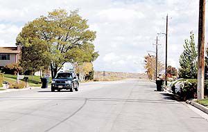
| The Homestead Boulevard loop proposes to extend Cedar Hills Drive and Homestead Boulevard and link them with a new east west facility. The planned facility would create a northern loop for the city of Price and would make access to the area easier for residents. |
At last Wednesday’s council meeting, city engineer Gary Sonntag presented Price officials with the environmental assessment for the proposed Homestead Boulevard loop project.
The proposed project is located in the northeast quadrant of Price city.
Adrea Clayton from Lochner Engineering presented an overview of the assessment during the Price City Council meeting on Oct. 11.
Full copies of the study are currently available at the city hall, Price library and the pubic works complex.
Informal flyers are also being delivered to surrounding property owners containing an overview of the project.
Public commentary will be accepted for 30 days in order to determine whether a public hearing is necessary.
The environmental impact study found no social or natural impacts on the land to be used for the project.
Lochner Engineering has been working with Jeff Smith from Questar in looking for any impacts the project would have on the gas company’s large transmission line which runs through the proposal area.
On behalf of Questar, Smith stated that, at the time of construction, the natural gas company that serves the area would request an upgrade.
“This road project is a proactive approach to growth we see headed our way,” stated Price Mayor Joe Piccolo.
According to the assessment, the loop project proposes to extend Cedar Hills Drive from 800 North and Homestead Boulevard from 900 North to link with a new east-west facility.
The proposed collector loop would be approximately 4,000 feet long and require an 80-foot right of way to accommodate a median turn lane, one travel lane in each direction, shoulders, curb, gutter and sidewalk.
Planning, design and construction would be funded by Small Urban Federal Aid revenues and may be augmented by local funding, according to the report.
The proposed loop would begin where the existing pavement ends at the intersection of Cedar Hills Drive and 800 North. The project would loop north, east and south, tying into the existing Homestead Boulevard at 900 North, where the pavement begins again.
In 1999, Price city applied to the Utah Transportation Commission/joint highway committee for federal aid funding of a small urban area, local government project known as “Homestead Boulevard Loop.”
The proposed project would create a northern loop to accommodate planned growth, provide access to city facilities, improve circulation and allow additional emergency routing in northeast Price.
The joint highway committee recommended the city’s connector loop road project for funding.
The Governor’s Office of Planning and Budget shows population in Price City increasing from 8,402 in 2000 to 11,481 in 2030. The city transportation master plan identifies the northeast quadrant of the city as one of three areas for development to accommodate this growth.
The study reports that the majority of existing housing in Price was constructed prior to 1980. It states that the purpose of the project is to promote new residential construction and expansion that would foster a progressive community image and attract new residents.
The availability of city services and infrastructure, including water, sewer and the proximity to existing community facilities, such as parks and schools, make this area ideal for further development.
Improved access to and from the project area is needed for both existing and future conditions. The needs for the project include problems related to circulation, access, safety, and accommodating planned growth.
The proposed loop, although not a designated bike route, would accommodate bicycle traffic on the shoulder. A proposed ATV trail north of the city would connect to a regional trail system and proposed cross country trail. Trail-head parking is provided at the Toy Atwood Baseball Complex.
“We have to be ready for the growth that is coming our way or we won’t be able to accommodate it,” concluded Piccolo.

