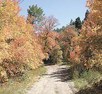
| What constitutes a road in Utah’s back counrty is often in question when it comes to legalities. Now there is a new plan for identifying roads to clear up some of the murkiness that exists over the issue. |
A plan has been announced to record a list of roads, identified as qualifying as public roads across public lands, in each county in Utah. Lynn Stevens, Utah State Public Lands Policy Coordinator made the announcement to the Utah Association of Counties (UAC) and to the State Legislature’s Natural Resources Interim Committee recently. The State and counties have been gathering information to identify the roads granted to them in accordance with the 1866 law referred to as RS2477.
As reiterated in the recent 10th Circuit Court of Appeals decision in the case of Southern Utah Wilderness Alliance (SUWA) and the Sierra Club versus the U.S. Bureau of Land Management (BLM) and three of Utah’s counties, no provision or requirement exists in federal law to make application for, or to provide proof of, construction of a road other than that which is governed by Utah law. Proof of the existence of a road and its continuous use by the public for 10 years or more prior to 1976 is sufficient under state law to confirm the validity of a road.
Because no recorded documents or filing of construction records were required at the time that roads were created, nor were they required at the time of passing the Federal Land Policy Management Act of 1976 (FLPMA), the state and counties have decided to put their roads on the record. This will make it easier to incorporate them into the land management plans currently being developed by federal land management agencies. By recording this information, anyone who has questions about the roads can go to the county recorder’s office and obtain specific legal descriptions of the roads involved.
“This should satisfy criticism that insufficient information is available regarding the existence, the description and the location of county roads,” said Stevens.
Additionally, the State of Utah and the U.S. Bureau of Land Management are working on an agreement to be made available to each county regarding how roads across BLM-managed land will be maintained. This agreement will also standardize road numbering systems and road signage within each county.
Stevens indicated that the initial recordings will start immediately and the process will continue until all qualifying roads are recorded in each county. While the validity of a few roads may still be at issue, thousands of uncontested and non-controversial roads will be identified in the county records.
The effect of the recording, combined with the maintenance agreement, should put an end to struggles and controversies over the majority of roads in the State of Utah.
Case law confirms the long-held position of the State and counties that the type of funds used for road construction and records of maintenance are not required to verify the existence of a road, and that the definition of a road has not changed since 1866.
“This recent ruling, consistent with other case law precedence extending back almost 140 years, should allow us to move forward quickly in resolving the few cases where the facts may still be in dispute,” says Stevens.
“The 10th Circuit Court decision reaffirmed the State’s and counties’ position that establishment of the existence of a road requires no action or acceptance by the BLM. Thus the State and the counties can move forward at their own pace.” stated Maloy Dodds, Garfield County Commissioner and chairman of the UAC Public Lands Steering Committee.

