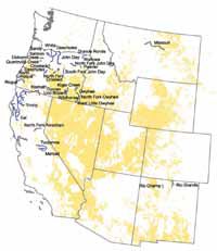
| Click on the image above for a larger, more readable map (large, ~71K) |
Multiple land use. Water rights. Restrictive use of private property. Loss of local taxes. Property swaps that could include state land, federal land or private land. Recreational uses that could go the way of the passenger pigeon.
The concerns have been voiced by local officials and some residents of eastern Utah concerning the upcoming inventory study on the Price River and other waterways by the United States Bureau of Land Management pertaining to the Wild and Scenic Rivers Act of 1968.
At present, the Carbon County Commission is considering language in a resolution that could affect the counties relationship with any action taken.
For some people, the idea that an act that was passed 34 years ago is only being looked at for this area now is absurd.
For others, it appears to be another card in the federal governments hand to not only control all the land in the west but the water as well.
Still others see this act as just another nail in the coffin of trying to take away the individual states rights.
The guideline is one of the most important and impacting pieces of conservation law ever enacted. It is complex with provisions affecting many kinds of resources including waterand water quality, minerals, agriculture, livestock grazing, fisheries and recreation.
To complicate the act even further, there are no less than five federal agencies that are responsible for implementing it, including the BLM, the primary agency that is working on the eastern Utah waterways.
The act declared a national policy to preserve certain rivers and their immediate environments, maintain free flowing conditions, protect water quality and fulfill other conservation purposes.
The original act by the U.S. Congress designated 156 specific waterways and since then others have been designated for study by the secretary of interior, as per the provisions of the law. The federal guideline includes normal agency planning processes in conjunction with their responsibilities.
The total number of rivers so designated for either wild, scenic or recreational now number 168 with more, which includes those in eastern Utah, under study.
A river can be deemed eligible by having any one or more of several outstanding remarkable values or ORVs.
The values are identified in the act as scenic, recreational, geologic, fish and wildlife, historic, cultural or other similar items.
Other unique items may be considered based on the professional judgment of agency officials.
Once a river has been inventoried and deemed eligible and suitable, it is given one of the three designations in the paragraph above. It is classified as such depending largely on the amount of existing development and accessibility when the study begins.
Once studies to determine the eligibility and suitability of a river for inclusion in the national system are completed, they are subject to public review and comment.
Management plans for the final designation are also put up for public review with written comments taken or a public hearing held.
Both land and access rights and water rights are dear to westerners. Many of the rivers affected and the communities that have faced the acts legacy are in the mid-west and east, where large tracts of private property lie along the waters of the streams affected.
But the west, too, has had it’s share of rivers studied and made eligible for the auspices of this law too. To see what could happen in Castle Country area if a stream is designated, it might be wise to see what has already happened in some other areas where the act has taken effect.
Two river systems in the northwestern United States that have been affected by the law are the Upper Deschutes River in central Oregon which is south of Bend, Ore., and the White Salmon River in south central Washington, located northwest of The Dalles.
The Upper Deschutes River was already under the auspices of the Oregon Wild and Scenic Act of 1988 when put under study for the federal guideline.
The study undertook 54 miles of the river with approximately 23 percent of the land being in private hands. That meant that 3,000 parcels of private land were within the a quarter mile of the river at the time of it’s designation.
Many of the parcels included in the study were developed into vacation as well as year round residences. But the private property wasn’t the only thing that had been highly developed at the locations along the Deschutes River. All of the river’s stored and natural flows were already allocated for other uses.
“This river is used heavily for irrigation,” indicated county commission chair for Deschutes County, Tom DeWolf. “A lot of it is taken out upstream and dumped back in lower down the river. To a certain extent the battle that went on during the inventory and designation here was about water.”
There are actually a number of limitations within the act that affect federal agencies.
One of the most important is that private lands within the boundary cannot be condemned if they are within any incorporated city, village, or borough which has in force and applicable to such lands a duly adopted, valid zoning ordinance that protects river values.
DeWolf was serving as a city councilman in Bend, Ore., during the time the inventory and eligibility studies were being conducted on the river in the 1980s.
“At that time, we passed a city river corridor protection act that helped us in regard to the designation,” explained DeWolf during a Wednesday morning telephone interview. “But other areas didn’t have that.”
DeWolf also pointed out that during the inventory and evaluation there was a large uproar over the designation, but once done, he has never heard another complaint.
George Reed, community development director for Deshutes County agreed with the former councilman’s assessment of the situation as well.
“Our experience has been mostly positive with what has gone on,” stated Reed. “But I think that is because we were proactive in getting some county ordinances about what and what could not be done along the river ourselves. The federal agencies involved basically ended up adopting our rules.”
But the changes enacted regarding the river affected some development projects proposed for the area.
DeWolf pointed out that, before the wild and scenic designation, a number of small hydroelectric plants were proposed for locations along the river.
Because of the wild and scenic river actions taken by the federal government, the hydroelectric plants were never constructed by the developers.
“There was also a bridge that was to be built in town and some in the community wanted it to be built outside the city,” explained DeWolf. “But it couldn’t be because of the designation, so it ended up in the original spot in the city.”
Reed is also a veteran in city planning in the area of the Rogue River in south western Oregon where that river was designated in the 1970s. He said the two situations he has been involved in were very different.
“Here the impact on the river by development was less and much of the property was already controlled by the federal government,” indicated Reed. “In the Rogue River’s case, there was a lot of private property. The forest service bought a lot of easements there and people weren’t unhappy about some of the restrictions because they got money out of it.”
In addition, Reed pointed out that the members of the local community involved in the Deshutes River case almost twisted the arm of the U.S. Department of the Interior to take actions to protect the waterway.
“We ended up with a real pro-river advocate on the county commission at the time,” explained Reed. “When we examine the business in our area, much of it is due to tourism. And when we survey people who come here as tourists, 80 percent of them respond that they are doing something in connection with the river, so protecting it was to the communities benefit.”
But Reed also pointed out that it is about more than land, it is also about water.
“There were some real water quantity issues,” commented Reed. “A lot of water is used for irrigation. I don’t know much about what is being done in eastern Utah or what your water situation is like, but any water that is earmarked for use before the designation will be protected. Afterward any other sources or new sources are not.”
In the matter of the White Salmon River, the entire designated area of 7.7 miles was located on private property. The particular designation included a significant United States Forest Service land acquisition program through the exchange and purchase of property from willing sellers.
Klickitat County and Oregon also developed as well as implemented more restrictive requirements, similar to what was done on the Deschutes River.
In fact, a couple of months ago a group of agencies asked that more of the river be inventoried.
“The way the river is set up now, it is highly used in our tourism business,” stated Jesse Burkhardt, the editor of the town of White Salmon’s newspaper, The Enterprise. “I wasn’t here when the whole study and designation took place, but it has turned out to be a positive thing.”
The county White Salmon is located in has about 19,000 people and their industries are lagging, particularly the timber industry.
Tourism is one of the only economic factors that has been positive.
According to state figures, residents of Klickitat County only average 70 percent of the income that others in Washington State make.
Of large concern to eastern Utahns is the possibility of the federal agency using eminent domain to condemn and secure property along the river if certain types of designations are awarded.
The concern has tended to be one of the most contentious issues when it comes to the scenic rivers act, particularly in the early study stages when many people aren’t sure what is going to happen.
In actuality, the process of condemnation of lands for this act has almost ceased since the early 1980s.
The use of eminent domain has only been used by federal agencies in the cases of four rivers; the Rio Grande in New Mexico (BLM); the Eleven Point River in Missouri (USFS); the ST. Croix River in Minnesota and Wisconsin and the Obed River in Tennessee (National Park Service).
The U.S. Fish and Wildlife Service, one of the other federal agencies that work with and use the act has never used eminent domain to secure fee title for a wild and scenic river designation.
The total number of acres taken by eminent domain actions has been 1,413.
Easements, however, created a different situation for the federal agency.
Overall easements on 6,339 acres have been condemned on eight rivers with the BLM (the agency that is doing the study on the drainage’s in eastern Utah) having used the process on both the Rio Grande in New Mexico with 2.7 acres and the Rogue River in Oregon with 518 acres.
Federal agencies have also purchased, without condemnation, thousands of acres of easements over the years as well.
The federal agency has just started the wild and scenic river process on the eastern Utah waterways. The inventory will take close to a year and the other steps that follow will take different amounts of time depending on public input, hearings and the processes of government in general.