In the early 1960s, the rock duo of Jan and Dean made music based on the California life of surfing and cars. One of their best known songs was a tune titled “Dead Man’s Curve.”
The song related the story of a young man who owns a Corvette and races it against a Jaguar XKE. During the race, the drivers get to dead man’s curve and he goes off the road but lives to tell about it, unlike many others who had died before him.
In the end, the young man vows to tell others to watch out for the ripple in that road and to never challenge it again himself.
Many parts of the country have Dead Man’s Curve types of places on roads and highways. Spanish Fork Canyon and U.S. Highway 6 have curves that could be a namesake for the song along the route starting at Moark Junction. As motorists head southeast up the canyon, the first thing they encounter after passing the Trojan Powder Works plant is a highway changing from a straight road into a curving, two-lane thoroughfare that can be disconcerting particularly at night.
And as the lights of the Wasatch Front fade away behind the 10,000 foot peaks of the mountains that surround the canyon, it becomes apparent to drivers heading up the canyon that many motorists coming the other way are impatient to get out of the winding 60 mile stretch from Price in a hurry. Often, motorists face long lines of vehicles coming down the canyon.
In many places, there are long fairly straight stretches of highway with good passing lanes. But when the bends show up, sometimes almost unexpectedly, motorists tend to continue to travel at straight road speeds.
It would be difficult to pick a single bend that could be considered Dead Man’s Curve in the stretch of road that travels to Soldiers Summit.
Some drivers would likely pick one of meandering bends in the road just above the entrance to the canyon. Others would pick the curves that exist between the Sheep Creek cutoff and where the roads bridge passes over the railroad tracks above Tucker.
But one curve that has seen more than its share of flipped over tractor trailer rigs is in the middle of the Red Narrows.
While the majority of fatalities occurring at one spot have not happened here,the curve is dangerous due to motorists ignoring the warning signs that precede the bend in both directions of travel.
The journey through the curves begins at Moark Junction. Entering the split in the mountains, motorists can see the signs of accidents.
Smashed guard rails and run down snow plow poles demonstrate the fact that many people have taken a less than direct route up that highway.
But while the signs of mishaps are there, less apparent is the fact that death has occurred often and quickly up this section of the canyon.
The first deaths in the canyon proper from 1996-2000 can be sited between mile posts 180 and 183, a section of the road motorists enter at the end of the trip through the mountains or follow while continuing east from the freeway where a 75 mile per hour speed limit is posted.
Five accidents occurring in the area killed six people from 1997 to 1998.
Then the road reaches a spot where it straightens out and turns into a four-lane highway right at the entrance to Covered Bridge Canyon. Until it reaches the base of Billy’s Mountain, the stretch has claimed a number of lives as people increase speed leaving the lower canyon curves.
Once the highway starts to climb the grade toward the kiosk commemorating the 1983 slide, the road is relatively death free during the five-year period – with the exception of a single fatality at the 185.33 mile mark in 1998.
But on the way down toward and past the cutoff to Fairview, the death toll mounts considerably, with a large group taking place where the four-lane road goes back to a two lane highway about two miles beyond the split of U.S. 6 and U.S. 89.
Then comes the flat section just before the Red Narrows, where accidents often happen from impatient drivers trying to get around large trucks. Close calls abound at the location.
The actual Narrows area has not created that many deaths, but has supplied plenty of close encounters and accidents over the years. Three distinct bends in the area are very dangerous, with Dead Man’s Curve seemingly the worst.
Almost all motorists who have driven the canyon on a regular basis have witnessed at least one accident in the area.
Most motorists have personally experienced close calls with vehicles traveling from the opposite direction and, misjudging speed, crossing the center line.
Past the narrows, the road opens up into a flat as it travels past the Sheep Creek cutoff. Even in the period from 1996-2000 before the road was widened, the death toll in the section was not high.
U.S. 6 was widened from three to four lanes two years ago and other improvements made the section much better.
Once past the flat, the curves start again. Some of the winding sections have resulted in deaths as people speed up through the flats and come to the sudden change.
Serious injury -fatal traffic accidents occurring between mileposts 194 and 197 caused considerable misery during the last few years of the 20th century.
The road curves back and forth until the highway reaches the overpass that crosses the tracks at milepost 201, where it travels in a straight line until just before Tucker where another curve fools many motorists traveling the canyon.
As drivers leave the rest stop headed east, the road starts its long climb to Soldiers Summit and turns into four lanes for about two miles, an improvement made three years ago.
U.S. 6 then converts back to three lanes with the eastbound traffic having two lanes just past where the rail lines cross under the highway once again.
No fatal crashes occurred on the designated section in the 1996-2000 period until the highway reaches the 205 to 208 mile markers, near where the road sluffed off in 1997 due to a slide.
The part of the road between 205 to 208 is particularly more dangerous for drivers who take chances than several other areas in the canyon are.
In the upper part of the climb, bends appear in the landscape and, with three lanes of roadway, motorists frequently attempt pass on a curve on the inside lane of oncoming traffic.
Finally, another flat looms on the horizon with a small hill and motorists arrive at Soldiers Summit and the Wasatch County line.
Leaving Soldier Summit, a separate set of traffic incidents begin as U.S. 6 heads toward Carbon County.
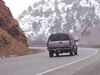
Bends, Curves Pose Hazard for Unwary U.S. 6 Travelers