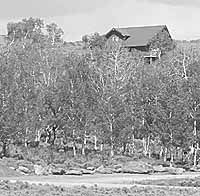
| A fire plug stands on a road some distance from cabins it serves in a mountain subdivision near Scofield Reservoir. Discussion at the Carbon County Planning and Zoning Commission once again centered around fire flows and water line pressures in such areas. The water line pressures and delivery rate expectations in mountain subdivisions where water systems are often private and small are somewhat lower than they are in the more developed areas of the county. |
Several months ago, Carbon officials thought they had adopted fire flow volumes and pressures that could be applied county-wide.
But in mid-August, the county’s planning and zoning department received a letter from the Utah Division of Environmental Quality questioning some of the parameters set by the local officials.
In a recent meeting, the county adopted various pressures depending on where a water system would be installed. Carbon officials had established a 45 pound per square inch pressure and a 200 gallon per minute flow in mountain home subdivisions.
But the letter from Dave Ariotti, the state division’s district engineer, questioned the specifications.
In the correspondence, the district engineer indicated he liked the idea that the county had come up with the provisions for fire flow.
But Ariotti said he felt the minimum fire flow ought to be 250 gallons per minute and that the 45 psi peak demand pressure was probably too high.
“I don’t believe a 45 psi minimum pressure at peak demand including fire (flow) is practical as this could push the normal operating pressures (of the water distribution system) too high, forcing use of system and/or individual pressure reducing valves,” stated the engineer. “These devices add additional maintenance, which is difficult for small (water) systems.”
Ariotti also specified that there is a minimum 30,000 gallon storage requirement for similar water systems. The requirement is designed to ensure that the 250 gallons of water per minute can be maintained for 120 minutes.
“That storage capacity requirement was not something I was aware of,” said planning and zoning director Dave Levanger. “That is something we need to look at. As for the changes in the flow levels I kind of like that number because it takes the middle ground between our required levels in the valley (500 gallons per minute) and what we were thinking about for the mountain developments.”
The issue resurfaced because the final approvals for phases one and two of the Scofield Mountain Estates was on the agenda at the Carbon County Planning and Zoning Board meeting Tuesday and the requirements directly affect the development project.
“We will do whatever is needed to provide for the proper flows,” said Jared Brown, the developer of the 56 lot project that is west of the present Aspen Cove mountain subdivision. Brown and his engineer maintain that the 60,000 tanks they are installing will provide the 45 psi and that the springs that supply the tanks can fill them within two days based on the flow that have been measured..
“I know there has been concern about the water supply there, but I have the permit work completed to drill a well if we need to do that to provide water to the development,” pointed out Brown. “However, even in the long drought that has gone on for years, those springs continue to supply the same amount of water they did almost two years ago when they were first measured.”
Levanger said that with the new information from the state, the department will be taking the a new revision on the pressure and flow standards for approval to the county commission.
Brown’s development also brought about a discussion about septic systems as well.
“I am concerned that the requirements the health department uses don’t meet what we are looking for in terms of what we see as being correct,” said zoning commission member Lynna Topolovec.
But Levanger told her that he wasn’t sure the county had or could put requirements on that part of development as long as the the developers were following what the health department required.
Brown then explained that he had personally dug many of the perk test holes and that all of them had tested correctly according to the parameters of what the health department required.
“This is not a problem with you or your subdivision, but a problem between us and the health department,” Topolovec told the developer.
After only slightly more discussion the planning commission gave final approval for the development.
The planning and zoning staff also presented a master transportation plan that they have been working on to the planning commission.
“This does not make a claim on any roads, but it does recognize them,” Levanger told the commission. “That includes roads on private land.”
He displayed a large map on the wall that included the entire county which had roads outlined in different colors depending on their status and funding.
“We want to be sure these roads are noted,” he said. “The day could come when access over federal or other public lands could be discontinued and we want to preserve access to these places.”
Commission member Earl Gunderson asked if any of the staff thought the plan would be controversial.
“That’s hard to know,” said Levanger in reply. “We will be having a public hearing on this plan at the county commission meeting on Sept. 15 so comments can be made then. When Emery County did this they went through some trouble over it.”
Road issues have been a hot button for many people and organizations over the past few years. Probably the best known dispute over roads lies in the RS2477. According to the Heritage Research Center, in 1866, when the Lode Mining Act with its public roads statute was passed, the General Land Office (GLO), a U. S. Department of the Interior agency, administered the country’s vast stretches of unreserved public lands. A departmental reorganization combined the General Land Office and the Grazing Service in 1946 to create the Bureau of Land Management (BLM), which continued the GLO’s duties. Roads or trails created during GLO / BLM land management are the focus of the Revised Statute 2477 and, hence, the Bureau’s policy for dealing with back country and little-used roads offers an important administrative commentary on statute interpretation. Passage of FLPMA (Federal Land Policy and Management Act) in 1976, with its provision for superseding RS2477, altered the legal landscape in which RS2477 rights-of-way controversies are settled by providing an alternate vision for land and resource management. In the past 25 years, Congress and the Departments of the Interior and Agriculture have wrestled with issues of intent and authority for grandfathered RS2477 rights of way. The issue continues to create problematic situations for many local entities as well as the federal government.
The planning commission also approved a two lot subdivision without improvements near 1800 West and 4000 North in Spring Glen, contingent on Spring Glen Water Company approval.